Kudat (Bahagian Kudat)
Kudat (Pekan Kudat) is the capital of the Kudat District in the Kudat Division of Sabah, Malaysia. Its population was estimated to be around 29,025 in 2010. It is located on the Kudat Peninsula, about 190 km north of Kota Kinabalu, the state capital, and is near the northernmost point of Borneo. It is the largest town in the heartland of the Rungus people which is a sub-ethnic group of the majority Kadazan-Dusun race and is therefore a major centre of Rungus culture. It is also notable for being one of the first parts of Sabah to be settled by Chinese Malaysians, particularly from the Hakka dialect group. It is the Northernmost Malaysian city.
What is now the Kudat area was originally named 'Tomborungan' by the local Rungus natives. It was named after the Tomborungus River, which has since disappeared. According to local lore, when the early British settlers asked for the name of the place, the local Rungus people misunderstood them and thought that they were asking for the name of a species of coarse grass which grows in abundance in the area. The grass is known as kutad in the Rungus dialect. This was eventually corrupted to 'Kudat' and replaced the old name of 'Tomborungan'.
What is now the Kudat area was originally named 'Tomborungan' by the local Rungus natives. It was named after the Tomborungus River, which has since disappeared. According to local lore, when the early British settlers asked for the name of the place, the local Rungus people misunderstood them and thought that they were asking for the name of a species of coarse grass which grows in abundance in the area. The grass is known as kutad in the Rungus dialect. This was eventually corrupted to 'Kudat' and replaced the old name of 'Tomborungan'.
Map - Kudat (Bahagian Kudat)
Map
Country - Malaysia
 |
 |
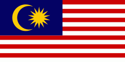
| Flag of Malaysia | |
Malaysia has its origins in the Malay kingdoms, which, from the 18th century on, became subject to the British Empire, along with the British Straits Settlements protectorate. Peninsular Malaysia was unified as the Malayan Union in 1946. Malaya was restructured as the Federation of Malaya in 1948 and achieved independence on 31 August 1957. The independent Malaya united with the then British crown colonies of North Borneo, Sarawak, and Singapore on 16 September 1963 to become Malaysia. In August 1965, Singapore was expelled from the federation and became a separate independent country.
Currency / Language
| ISO | Currency | Symbol | Significant figures |
|---|---|---|---|
| MYR | Malaysian ringgit | RM | 2 |
| ISO | Language |
|---|---|
| ZH | Chinese language |
| EN | English language |
| MS | Malay language |
| ML | Malayalam language |
| PA | Panjabi language |
| TA | Tamil language |
| TE | Telugu language |
| TH | Thai language |


